

Localities
My Journey Through Colombia’s Emerald Regions
Aug
Colombia is world-famous for its exceptional emeralds. During two journeys, I visited some of the country’s most important deposits and had the opportunity to experience not only their geology, but also emerald mining and life in the mining regions at close range. This article combines my personal impressions with the geological background of the deposits.
- 1 Why Did I Travel to Colombia in the First Place?
- 2 Preparing for the Journey – Assessing Risks and Potential Hazards
- 3 How a Daring Plan Takes Shape
- 4 Colombia’s Emerald Belts
-
5
Journey to Gachalá
- 5.1 On the Ruta del Guavio: The Road Above the Clouds
- 5.2 The Descent into the Guavio Valley
- 5.3 Our Geological Guide
- 5.4 The Guavio Reservoir
- 5.5 Arrival in Gachalá
- 5.6 The Hunt for the Green Fire
- 5.7 Heading to the Mines of the Gachalá District
- 5.8 The Mine Visits – Palomas, El Manantial, and La Emilia
- 6 Journey to Chivor
- 7 Gachalá and Chivor – Similarities and Differences
- 8 Via Chiquinquirá to Muzo and the Western Emerald Belt
- 9 On the Way to the Western Emerald Belt – The Districts of Maripí, Coscuez, and Muzo
- 10 La Pita Mine in the Maripí District
- 11 The Journey to Muzo
- 12 A Visit to the Coscuez District
- 13 Eastern and Western Emerald Belts – Similarities and Differences
- 14 Conclusion of My Journey Through Colombia’s Emerald Regions
- 15 References
Why Did I Travel to Colombia in the First Place?
How did I actually come to embark on this adventurous yet physically demanding journey to Colombia’s emerald mines?
As a geologist and passionate mineral collector, I had long been fascinated by the green variety of beryl and its characteristic inner fire. Having studied economic geology, I was interested not only in emerald as a mineral, but above all in the formation of the legendary deposits of Muzo and Chivor.
During my time as a doctoral researcher at the German Mining Museum in Bochum, the idea gradually took shape of developing my long-standing passion for collecting minerals into a professional venture as well. It was during this period that I founded “Mineralien weltweit”. At the same time, a fortunate coincidence made the plan even more appealing: I had a girlfriend in Bogotá at the time. This gave me the idea of combining a private visit to Colombia’s bustling capital with a geological expedition and spending several days exploring the country’s famous emerald deposits firsthand.
After my longer stays in Peru and Chile, I was immediately enthusiastic about the idea.
Preparing for the Journey – Assessing Risks and Potential Hazards
My greatest advantage was that, after spending four months in Peru and a year in Chile, I already spoke Spanish very well. Even so, the more I researched, the clearer it became that travelling through Colombia’s emerald regions would not be entirely straightforward. Several aspects in particular occupied my thoughts during the preparations:
- The history of the so-called Emerald Wars (Guerras Verdes): For decades, parts of the western emerald belt in particular were shaped by violent conflicts over mines, trade, and influence. These clashes culminated in the 1980s in the so-called Green War, during which thousands of people lost their lives. In 1990, a peace agreement was reached through the mediation of the Catholic Church [1]. Although the situation has changed fundamentally since then, I was aware that the mining regions still had a very distinctive social and economic structure and that access to individual mines was by no means guaranteed.
- Road conditions: A significant part of the journey to the mines would take place on unpaved roads and rough tracks, known locally as trochas. Steep climbs, heavy rainfall, and landslides could make access to the remote mining regions even more difficult.
- The emerald trade: For an outsider, the trade in rough emeralds is difficult to assess. Quality, treatment, and value can vary considerably. Fractures in particular play a major role in emeralds. Filling surface-reaching fractures with oil has long been common practice and has also been extensively documented specifically for the trade in Colombian emeralds in Bogotá [2]. For me, this meant examining offered specimens especially critically. In Coscuez, I also experienced firsthand that emeralds were moistened with water before being offered for sale. This made fractures and surface imperfections significantly more difficult to detect. On a very practical level, there was also the fact that reliable access to cash could not always be expected in remote mining towns.
- Climate and underground conditions: I was already familiar with the physical demands of this kind of journey from my previous stays in Chile and Peru. I was also not particularly concerned about high altitudes, having already travelled at elevations of more than 5,000 metres without major problems. I expected the more challenging conditions to be underground. Adequate mine ventilation is essential in underground mining. Colombia’s National Mining Agency, the ANM, requires, among other things, monitoring of air quality, temperature, and relative humidity, as well as an adequate supply of fresh air [3]. During my journey, I would experience firsthand on several occasions just how differently these requirements were implemented in practice.
How a Daring Plan Takes Shape
With these considerations in mind, my girlfriend and I quickly realized that travelling through the emerald regions on my own would not be a good idea. I needed a local guide and an experienced driver—someone who knew the area, was familiar with the difficult road conditions, and could assess potential risks better than I could.
Fortunately, my girlfriend in Bogotá at the time proved invaluable in this regard. Through her, I was able to establish direct contact with the man who would later become my driver. I quickly came to trust him greatly, and he would go on to guide me safely along some extremely rough and difficult trochas.
This settled an essential part of the logistics. What I still lacked was professional access to the mines. I specifically looked for a Colombian geologist who could accompany me at least during the first few days in Gachalá and help me better understand the local deposit structures and geological relationships.
At the same time, I was pursuing a rather daring plan: I hoped that this initial contact would lead to further connections within the regional tourism and mining community. Ideally, I would meet someone who could later accompany me to Chivor, Muzo, and Coscuez or, in turn, put me in touch with new contacts there.
It was a plan that relied heavily on trust and on meeting the right people along the way. In fact, that is exactly what happened.
I was therefore relieved as the individual pieces of the organisation gradually began to fall into place. Good local knowledge and reliable assistance, however, came at a price: the Colombian geologist charged €250 per day and per person. For my expedition budget, this was a considerable amount. From the outset, I therefore knew that he would accompany me only during the first stage of the journey in Gachalá.
His role was nevertheless crucial to me: he was not only meant to explain the geological context, but also to serve as a door opener to the contacts that would allow me to continue the journey towards Chivor, Muzo, and Coscuez afterwards on a significantly smaller budget.
Colombia’s Emerald Belts
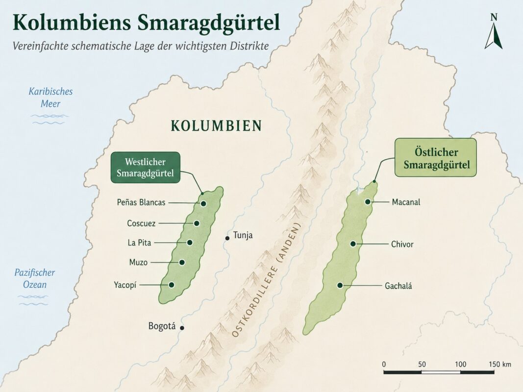
Colombia’s most important emerald deposits are concentrated in two belts along the flanks of the Eastern Cordillera. Muzo and Coscuez belong to the western emerald belt, while Chivor and Gachalá are part of the eastern emerald belt. In both regions, the deposits are sediment-hosted, hydrothermal emerald deposits occurring within Cretaceous sedimentary sequences [4]. The two belts differ, however, in several respects, including their stratigraphic host rocks, tectonic evolution, and the age of emerald mineralization [5].
My journey took me through both belts and gave me the opportunity to directly compare their landscapes, mining areas, geological settings, and minerals.
Journey to Gachalá
When people talk about emeralds from Colombia, names such as Chivor, Coscuez, and Muzo are often the first to come to mind. The western emerald belt in particular tends to dominate public perception. Yet the Gachalá district has also produced some exceptional emeralds.
In 1967, the famous Gachalá Emerald was discovered at the Vega de San Juan Mine. The uncut crystal weighs 858 carats and was later donated by Harry Winston to the Smithsonian National Museum of Natural History [6].
As a geologist specialising in economic geology, it therefore seemed natural to begin my journey in the Gachalá district. Like Chivor, Gachalá is part of Colombia’s eastern emerald belt.
At exactly 9 a.m., Jaiver picked me up in front of my then-girlfriend’s apartment in Bogotá. Although his car did not have four-wheel drive, I immediately had a good feeling about him. I already sensed that we would get along well.
On the Ruta del Guavio: The Road Above the Clouds
We left the urban chaos of Bogotá behind and headed east, first crossing the steep Cerros Orientales. Beyond La Calera, the paved roads increasingly gave way to unpaved tracks and gravel roads.
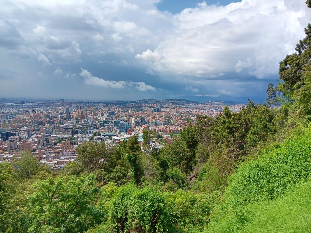
Via Guasca and Junín, our route continued into the cloud-covered heights of the Tierra Fría and towards the foothills of the páramo. At temperatures sometimes below 10°C, we repeatedly passed stands of frailejones. These characteristic high-altitude plants are among the defining features of Colombia’s páramo landscapes and are particularly widespread in the Eastern Cordillera [7]. With their silvery, hairy leaves, the plants appeared almost like silent guardians of the highlands in the dense Andean mist.
The Descent into the Guavio Valley
Beyond Junín, the landscape changed noticeably within a short distance. The road now descended steeply into the valley of the Río Guavio. Along the way, we experienced the pronounced altitudinal zonation of the Andes firsthand: the cool air of the highlands gradually gave way to subtropical warmth and high humidity, while the open highland vegetation was increasingly replaced by denser montane and cloud forest with ferns and the first banana plants.
The Ruta del Guavio now ran in places directly along steep rock faces. On the narrow road, encounters with fully occupied buses coming the other way repeatedly became a test of patience. Particular concentration was required along the unprotected drop-offs.
Our Geological Guide
In the area around Gachetá, we were joined by Alex, a Colombian geologist who was to help us gain access to the mining regions. Our meeting point was not far from salt deposits of the Eastern Cordillera—geologically fitting, since highly saline, evaporite-influenced fluids played a crucial role in the formation of Colombia’s emerald deposits [8].
From that point on, there were four of us travelling together. At the same time, the most expensive phase of the journey began: our guide charged €250 per day, so we had to make the most efficient use possible of the days ahead.
The Guavio Reservoir
Shortly before Gachalá, the valley opened up and revealed a view of the Guavio Reservoir. The vast reservoir lay like an artificial emerald between the steep, deep-green mountain slopes.
Along the road, thick Cretaceous sedimentary sequences with dark claystones and black shales were repeatedly exposed. Such Lower Cretaceous sedimentary rocks form an important part of the geological setting in which emerald mineralization of the eastern belt developed [1]. After more than five hours of driving over rough roads, past smaller landslides, and through unlit rock tunnels, we finally reached Gachalá. We had arrived in the eastern emerald belt—and the expedition itself could begin.

Arrival in Gachalá
By late afternoon, we finally reached our destination. The village centre of Gachalá nestles picturesquely along the western side of the reservoir. At the Plaza del Mercado, we met our guide Alejandro, whom our geologist had contacted in advance. My plan seemed to be working.
After the long and dusty drive, we first wanted simply to arrive and catch our breath. We were welcomed with typical Colombian hospitality: Alejandro offered us regional cheese and traditional Andean sweets. This was accompanied by a small cup of Colombia’s ubiquitous sweet, mild coffee—a tinto.
Over this first relaxed coffee, we talked casually about the following day and outlined the rough route to the collecting sites. The ice was quickly broken. After coffee, I was offered several emeralds from the Gachalá District, and I bought them without hesitation. Now the actual search for the legendary emeralds of the Gachalá District could begin.
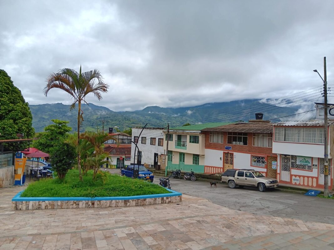
The Hunt for the Green Fire
After discussing the logistical details for the coming days over cheese and tinto the previous evening, we settled into our accommodation. When I opened the door the next morning, the view almost took my breath away: our lodging was perched on the steep slopes high above the majestic Guavio Reservoir.
The sight of the mirror-smooth, deep blue water, over which dense, low-hanging clouds of the Andean Tierra Templada drifted, was marked by an almost mystical calm. The lush green mountain slopes were reflected in the lake—a panorama that immediately reminded me why I had undertaken this journey. It was precisely in these mountains, deep beneath the green cover of the cloud forest, that the hydrothermal veins containing the legendary beryl crystals were hidden.

After a quick early-morning dip in the pool, the first order of the day was a tinto. A little later, our geologist Alex joined us. He brought along an excursion plan, which he handed to me. He gave me a general overview of where we would be going, which outcrops we planned to visit, and which geological formations were crucial to the formation of the emerald deposits in the district.
I listened carefully without feeling that I had to memorize every detail immediately. One of the great things about geology is that much of it becomes far more tangible once you see the actual landscape and outcrops for yourself. For the time being, the main point I kept in mind was that in the Gachalá district, the Lower Cretaceous Santa Rosa Formation is regarded as the principal stratigraphic host formation for emerald mineralization. The emeralds typically occur there in hydrothermal veins and breccias, accompanied by minerals including albite, calcite, dolomite, and pyrite [9].
Alejandro then explained that the deposits lay on the other side of the reservoir and that it would take us more than an hour to reach them over gravel roads and rough tracks. I was accordingly eager to see what awaited us.
Heading to the Mines of the Gachalá District
The drive to the mines over gravel roads and rough tracks took a little over an hour. I was particularly curious about the route, as our car did not have four-wheel drive.
After only a few minutes, we reached the first geological outcrop. In front of us was a sequence of the Ubalá Formation. Like the Santa Rosa Formation, it belongs to the basal units of the Lower Cretaceous and is assigned to the Berriasian. Both formations were deposited at approximately the same time, but represent different local facies developments within the eastern emerald belt [10].
The outcrop already made it clear that the Ubalá Formation is lithologically very diverse. Alex explained that it includes limestones, sandy to quartz-rich sandstones, as well as claystones and siltstones. Fossil-rich limestones containing bivalve remains are particularly characteristic in some areas. In the vicinity of the Guavio Reservoir, the formation reaches a thickness of at least around 150 metres. It rests unconformably on the Paleozoic rocks of the Farallones Group [10].
We continued our drive towards the other side of the reservoir. Alex explained that extensional tectonics had played an important role in the formation of the emerald deposits of Gachalá and Chivor. Detachment horizons, listric normal faults, and extensional fractures were particularly important for fluid circulation. These structures allowed highly saline hydrothermal fluids to migrate through the rocks and promoted the formation of breccias, veins, and other open spaces in which minerals including albite, calcite, dolomite, pyrite, and emerald could crystallize [11].
One distinctive feature of many Colombian emeralds is the presence of multiphase fluid inclusions. In addition to a highly saline liquid, they often contain a gas bubble and one or more cubic daughter crystals, usually halite. These salt crystals formed as the originally trapped brine cooled [12]. Such highly saline fluids are known from deposits in both the eastern and western emerald belts. Their composition indicates that evaporite-influenced basinal fluids played a central role in the formation of Colombia’s emerald deposits [11][12].
The Mine Visits – Palomas, El Manantial, and La Emilia
One of the main goals of my journey was to gain a better understanding of where the emeralds actually come from and how they are mined on site. I wanted to see the conditions under which the miners work, what their daily routines are like, and how the geological settings differ from one district to another. Over the course of two days, we visited several mining sites of varying sizes around Gachalá.
Unfortunately, we were unable to visit the historically important Vega de San Juan Mine. I would have particularly liked to take a look underground there, since one of the most famous Colombian emeralds ever discovered came from this mine. Perhaps another journey will provide the opportunity.
Instead, we visited several mines in the Palomas area as well as the more modern La Emilia operation. Palomas was of particular interest to me because, in addition to emeralds, the area is also known for discoveries of euclase.
The Palomas Settlement Area
On the first day, we visited two mines in the Palomas settlement area. Before entering the first mine, we stopped briefly to take a photo with the miners.
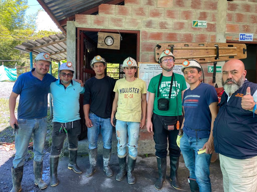
The entrance was located about 15 to 20 vertical metres below the road. Alex explained that rocks of the Santa Rosa Formation were exposed here. Together with the four miners from the group photo, we entered the adit.
We spent around an hour underground. One of the miners explained that the emeralds occur mainly in calcite veins and at intersections where several veins meet.
For tunnel development, holes were first drilled into the rock using pneumatic rock drills. One of the miners then explained that dynamite was placed in these holes. After blasting, the workers removed the broken rock from the adit and searched specifically for mineralized veins and emerald-bearing sections.
What particularly made me reflect was the limited protective equipment. According to the miners, during blasting operations they wore only a cloth over their mouths; there was no proper eye protection.
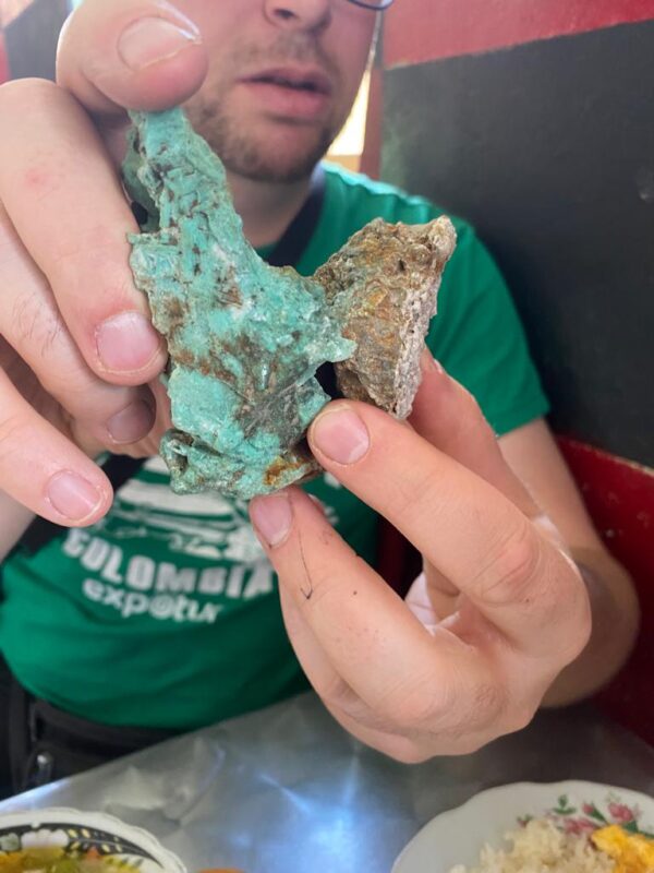
I was also surprised to learn that a large proportion of the emerald material recovered consisted only of fragments a few millimetres in size. One of the miners explained that damage to crystal faces caused by mining and blasting was not uncommon. He showed me a small emerald embedded in the dark rock that I would probably have overlooked without his guidance.
The humidity inside the adit was extremely high. My respect for the physically demanding work of the miners underground and under such basic conditions grew with every minute.
We eventually left the mine through an almost vertical shaft. From below, daylight could already be seen at the upper exit.
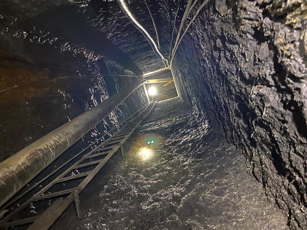
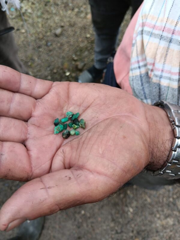
Fortunately, once we were back outside, there was first of all a tinto. While drinking it, I got into a conversation with one of the miners. He showed me a sealed plastic bag containing tiny emerald crystals from the mine we had just visited.
Alex explained that they were genuine emeralds from the Santa Rosa Formation. On the spur of the moment, I decided to buy the small bag as a souvenir of this special mine visit.
The El Manantial Mine
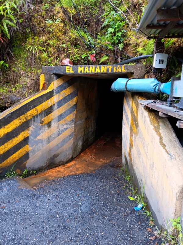
We then visited the El Manantial Mine, not to be confused with the mine of the same name in the Chivor district. It was a small family-run mining operation worked by artisanal miners. Such smaller-scale operations continue to play an important role in the region’s emerald mining industry. They often rely on relatively simple equipment and involve considerable physical effort.
By my estimate, the main adit extended for several hundred metres. In places, the water inside was about ankle-deep. Fortunately, we were all equipped with rubber boots.
I was told that mine dewatering is a major challenge in the Gachalá district due to the high rainfall and the constant inflow of groundwater from the surrounding mountains.
Another small-scale mine was located in the immediate vicinity. Since two miners gave me different names for it when I asked, I have deliberately refrained from identifying it more precisely here. The safety precautions appeared even more basic than at the operations we had previously visited. There were clearly considerable differences between individual mines in terms of equipment, organisation, and occupational safety.
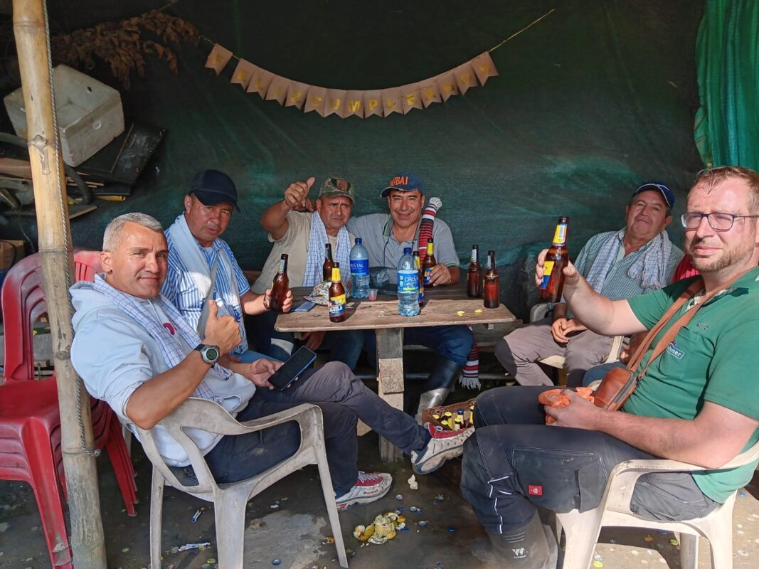
Late in the afternoon, we were kindly invited to have a beer at the home of one of the miners. The warmth and hospitality with which we were welcomed both surprised and impressed me. They wanted to know why I had undertaken this journey and where I came from.
A pleasant and relaxed conversation developed. Naturally, I was also shown emeralds and other minerals. Among other specimens, the owner of the Montecristo Mine showed me an impressive rock crystal cluster from Santander.
Once again, I became aware of just how exceptional larger emerald crystals are when they are also largely undamaged. Several favourable conditions must come together for such crystals to form, be exposed, and ultimately be recovered intact. This rarity, together with the considerable amount of work involved, should certainly be taken into account when assessing their prices.
At the same time, the modest living conditions made me realize how simply many of the miners we met lived and worked.


After a few beers and several mineral purchases, we finally made our way back to our accommodation in Gachalá. I opened the window and watched the lush green landscape of the region pass by.
Explotaciones Minerals La Emilia S.A.S.
The visit to the modern, privately operated La Emilia mine the following day offered a striking contrast to the small-scale mines we had previously visited in the Palomas mining area. La Emilia is a comparatively modern and more highly organised emerald mining operation in Vereda El Diamante near Gachalá. The operation is also currently documented there under the name Explotaciones La Emilia S.A.S. [13].
The present-day concession operation should not be confused with older workings or adits that were also known as La Emilia in the historical emerald mining of the region. The associated mining title is registered by Colombia’s mining authority under the identifier HK9-08091 [14]..
I was allowed to take photographs at the mine site; however, the images taken there may not be published.
Overall, the operation appeared to me to be considerably more structured and more strictly regulated than the smaller mines we had visited previously. This impression was consistent with the fact that, in 2024, CORPOGUAVIO conducted a mining safety training session on the premises of Explotaciones La Emilia S.A.S. with representatives of the local mining community, companies, and employees [13].
I was particularly impressed by La Emilia’s water management system. Water accumulating in the mine was collected, pumped to the surface, and treated there. Part of the treated water was then reused, including for washing and cleaning the extracted rock. Excess water was discharged in a controlled manner after treatment. At the mine exit, a miner carefully examined the rock fragments brought to the surface for emeralds.
I was able to purchase several emerald specimens from the La Emilia Concession directly from the miner. One small emerald on matrix surprised me with its intense bluish-green color and remarkable transparency for its size. The specimen showed that this mine is certainly capable of producing crystals of appealing quality.


Journey to Chivor
We left for Chivor the very next day. Alex returned from Gachalá to his family, while Alejandro would continue accompanying us over the following days.
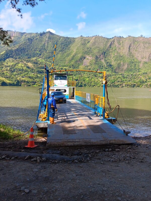
After a journey of around eight hours, we reached Chivor in the evening. Along the way, we crossed the Chivor Reservoir by vehicle ferry. Our hotel was located directly on the town’s plaza.
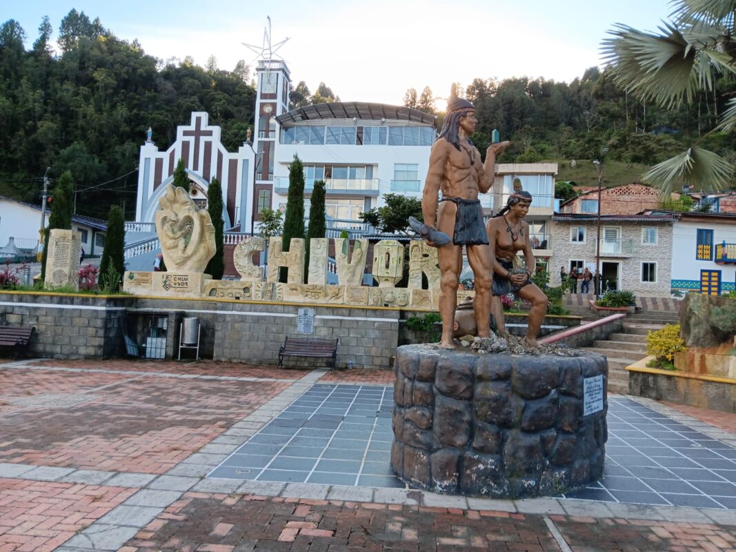
At the centre of the square stands a sculptural representation of Indigenous figures closely associated with the symbolism of the emerald. By this point, at the latest, it became clear just how important the green variety of beryl is to the cultural and economic identity of the region.
Chivor is considered the youngest municipality in the Department of Boyacá and was only established as an independent municipality in 1990 [15]. Its importance in mining history, however, reaches back much further. Emeralds were already being mined in the region long before the Spanish conquest and were distributed through pre-Columbian trade networks. Historical sources and later studies indicate that emeralds from the area of present-day Chivor reached as far north as Mexico and as far south as the Inca realm [8].
After the Spanish conquest, emeralds from Chivor were eventually exported to Europe as well. There, they found their way particularly into the possession of royal families, the nobility, and the Church, and quickly became highly sought-after gemstones [8].
Alejandro had already established a contact in Chivor. Shortly after our arrival at the hotel, we were warmly welcomed and introduced to José. Wearing knee-high rubber boots, he was dressed in a way typical of many miners working in the region’s emerald mines.
During our conversation, we learned that a four-wheel-drive vehicle with a differential lock would be essential for reaching the mines the following morning. We quickly agreed on a price for the next adventure. My anticipation grew: I was particularly interested to see whether I would recognize geological similarities with the Gachalá district, since Chivor also belongs to Colombia’s eastern emerald belt.
Visiting Individual Mines in Chivor
The next day, we were picked up after a substantial breakfast. In Colombia, people seemed to place great importance on a hearty morning meal—which was certainly not the worst preparation for the day ahead underground.
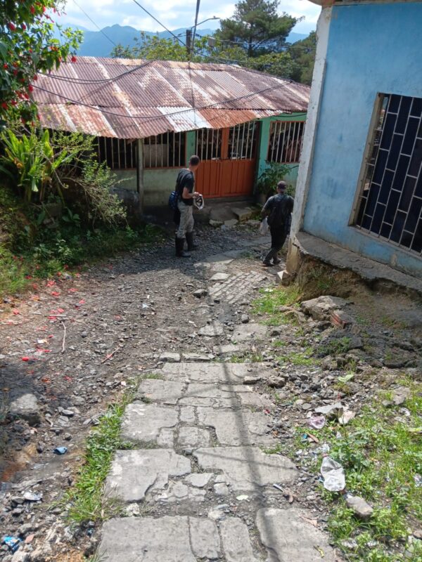
It quickly became clear that the mining district lay far outside the town centre and could only be reached via steep, unpaved tracks. We were shaken around quite a bit during the drive, and I was glad that our driver knew how to handle the difficult terrain. More than once, I wondered at what point we would probably have had to turn back with Jaiver’s car.
At mineral shows, I had repeatedly seen emerald specimens labelled simply as coming from the “Chivor Mine.” Once there, however, I quickly realised that this designation is a considerable simplification. Chivor is not a single mine entrance, but a historically developed and highly subdivided mining district with numerous concessions, adits, galleries, and older workings [16].
During the drive, mine entrances and smaller adits repeatedly appeared along the slopes. In places, the mountain really did remind me of Swiss cheese. It was obvious that during our two-day stay I would only be able to explore a small part of this complex mining district. Many of the smaller workings could hardly be assigned with certainty to a specific mine on site, especially since some names appeared to be used only locally.
The overall picture is further complicated by the fact that different mining areas and concessions extend beyond the immediate surroundings of Chivor. The neighbouring area of Macanal also belongs geologically to the eastern emerald belt and hosts significant emerald deposits of its own. For a future journey, this region would therefore be an obvious next destination.
Our companions divided the area for us into several traditional or locally used sectors:
- Chivor sector: the historic core of the mining district. It includes older workings such as Banco Klein, as well as numerous modern galleries and adits. Historical literature records that Fritz Klein worked the Chivor deposit in the early 1920s using open-pit or terrace-like surface workings [17]. This area also contains the striking rock formation El Púlpito, a historic landmark of the Chivor mine [8].
- San Francisco sector
- Gualí / Quebrada Gualí sector
The modern mining landscape, however, is far more fragmented than this broad subdivision might suggest. Numerous mines and galleries are reported from the area, including San Pedro, San Gregorio, Manantial, Gualí, Dixon, Tesoro, Milenio, Porvenir, Catedral, Klein & Cuatro, and El Púlpito [16].
The Chivor Sector
After a little more than half an hour, we reached our first destination. We were now in the historic core of the district. Shortly after getting out of the vehicle, I was confronted with an impressive scene.
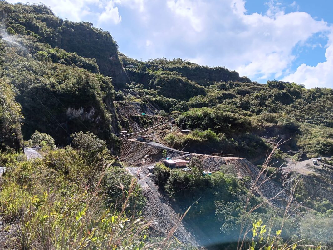
Before me opened the Sinaí Valley. On the left, an almost vertical rock face rose steeply, while the rest of the mountainside was divided into numerous terrace-like mining and working levels. Historical photographs and reports show that the Chivor emerald deposits were for a long time also worked in open, terraced excavations. Today, however, mining is carried out almost exclusively underground [16].
Whether the almost vertical rock face on the left had also been created or at least modified by earlier blasting could not be determined with certainty on site. José was unable to give me a definite answer on this point.
Several mining and working levels, along with numerous adit entrances and old mine openings, could be seen across the terraced slope. According to our companions, some of these entrances belonged to the workings of Galería Los Topos.
Of course, I would not want to withhold this first impression from you.
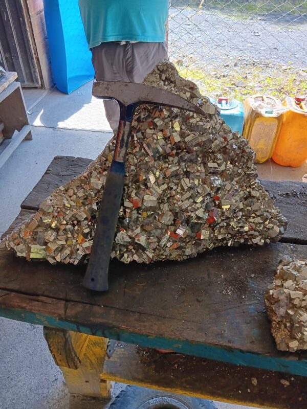
By now, I could hardly wait to enter some of these adits myself. On one of the working levels, I was shown a large pyrite specimen inside a makeshift tent. One of the miners asked whether I was interested in buying it. After a brief inspection, however, I decided against it. The specimen was not only exceptionally large, but probably also so heavy that transporting it would have become a considerable problem.
Later, we entered two adits in the area of Galería Los Topos: Túnel 4 and Túnel 5.
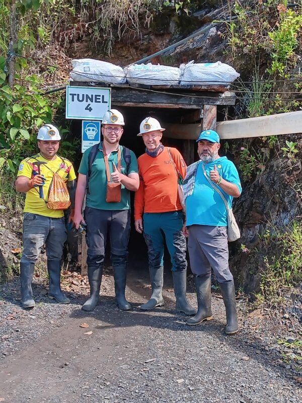
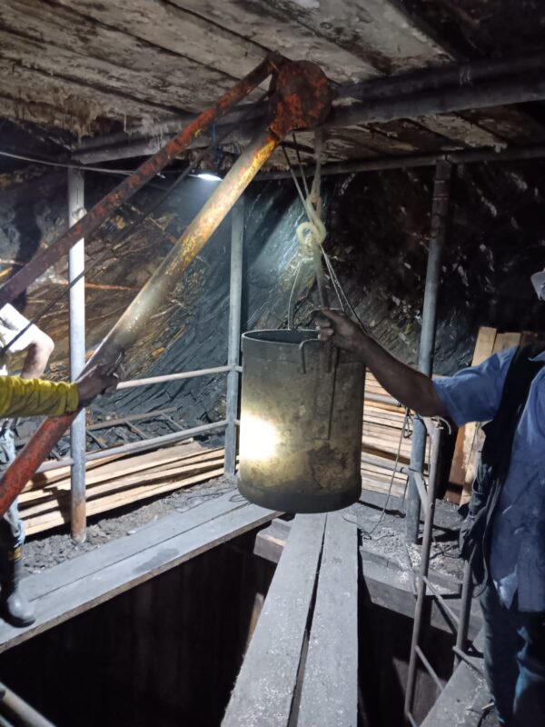
In Túnel 4, a vertical timber-lined shaft had been sunk. Waste rock was hauled to the surface in a metal bucket using a simple rope-and-pulley system, then transferred into a mine cart and transported out of the adit. Here too, the miners worked with pneumatic rock drills.
At times, the air was extremely stuffy. Given the high humidity, dust, and physically demanding work, I found myself wondering how the miners endured these conditions for hours at a time.
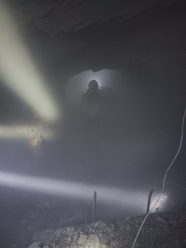
In Túnel 5, we climbed through an upward-sloping working until we reached the area where mining was currently taking place. A pneumatic rock drill was in operation there. Within a very short time, fine rock dust filled the entire cavity, reducing visibility to only a few metres. It was like looking into a dense wall of fog. Comparable working conditions, with extremely heavy dust generation while drilling into black shale, have also been documented in other Chivor mines [1].
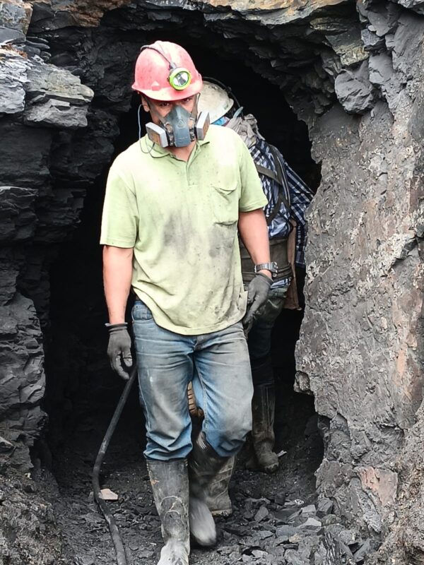
Some of the miners wore respiratory protection, but worked without safety goggles. Under these conditions, this seemed particularly risky to me, as dust and small rock fragments could easily get into their eyes.
One of the miners explained that here, too, the emeralds were found mainly within mineralized veins—particularly where several veins intersected. In Chivor, emerald mineralization is indeed closely associated with hydrothermal veins within the folded and fractured sedimentary rocks [8].
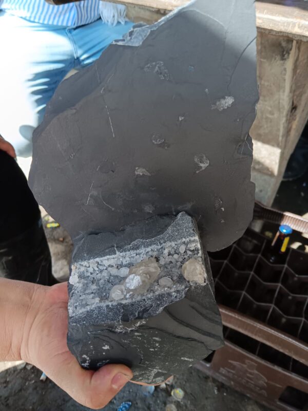
In the lower workings, another miner finally showed me an emerald directly in the exposed rock. To be honest, I had to look very carefully at first before I could even make it out. Only a small green area was visible against the dark, damp host rock.
Can you spot the emerald in the photo?
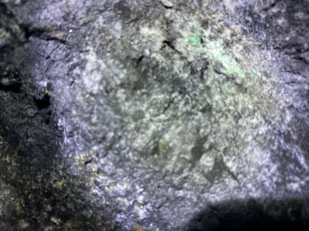
Whether it was actually a single crystal or merely an emerald-bearing zone could not be determined with certainty on site. What was clear, however, was that crystals can repeatedly be damaged during work with rock drills and explosives. For this reason, once mineralized veins have been exposed, they are sometimes worked carefully with hand tools in order to recover any emeralds as intact as possible [1].
Because of the high humidity, we eventually left the tunnel again. Within just a few minutes, my glasses had already fogged up completely. A little higher up, we watched as a newly started adit was being advanced further with a pneumatic rock drill.
Meanwhile, blasting was being prepared in another working. We observed the procedure from a safe distance. After several minutes, the explosive charges had apparently been placed in the drill holes. Shortly afterwards, the miners left the area in visible haste.
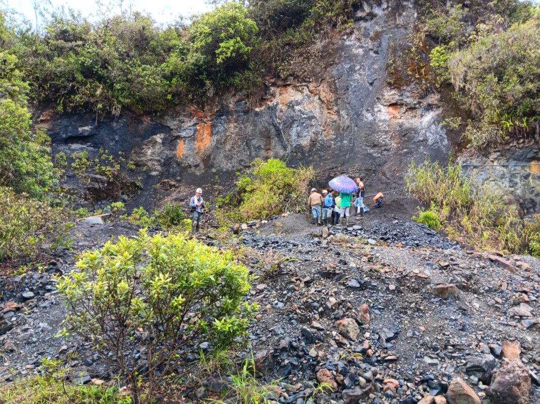
A few minutes later, a dull blast echoed through the air. Shortly afterwards, we heard the crash of loosened rock blocks before a dense cloud of dust spread from the mine entrance.
Later, we shared a tinto with several miners in a simple shelter. There, I was offered a lot of emeralds from the Los Topos area—and I did not have to think long before buying them.
On the way back to Chivor, we made a brief stop at the striking rock formation El Púlpito. The formation also has historical significance: in the 1920s, Peter W. Rainier placed an iron boundary marker there along the edge of the Chivor concession at that time [8]. I was also struck by the almost reverent way some of the miners spoke the name. According to their stories, particularly fine emeralds had been found in this area in the past.

By late afternoon, after being thoroughly shaken around in the four-wheel-drive vehicle, we arrived back in Chivor. First, we wanted to get something to eat—perhaps chicken with rice, a true South American classic.
By now, word had apparently spread that I was interested in emeralds. Several people addressed me directly as “Pool”—meaning Paul, of course—and offered me their stones.
Emeralds Offered on the Plaza
José told me that a new find had been made during the day and showed me a video of it. We agreed to meet on the plaza in the early evening so that I could examine the specimens. Beforehand, I wanted to freshen up a little at the hotel.
When I later looked out of the window, I noticed that several people had already gathered on the bench in front of the hotel. Apparently, they were waiting to offer me their emeralds from the Chivor District.
Outside, I quickly realised that the quality of the specimens on offer varied considerably. Some were fairly simple reference specimens, while others were well-formed, intensely green emeralds. As I examined them, I also noticed that many of the green beryls were set on a light-coloured matrix.
It soon became clear that buying an entire lot was often far more economical than purchasing individual specimens or crystals. The fact that emeralds in Chivor are offered directly by miners and dealers in homes, offices, and on the street is also described in the specialist literature [1].
With expectant looks, people showed me numerous specimens: emeralds, pyrite, and also rock crystal. Asking prices varied enormously, ranging from 10,000 pesos for small fragments to 50 million pesos for a faceted step-cut emerald.
Some negotiations were quite relaxed, while others proved considerably tougher.
I became increasingly aware of just how closely the lives of many Chivor residents were tied to emerald mining. One miner had apparently lost a leg in a mining accident, while another suffered from severe vision problems.
Later, we visited the home of our companion Jorge. He too wanted to show me a few more specimens. There, he introduced me to his girlfriend—and, fittingly enough, her name was Esmeralda.
Gualí Mine
The following day, our route took us into the Gualí sector. Unlike the historic core of Chivor, the area appeared to be more fragmented into individual adits, concessions, and smaller working areas. Here too, steep access roads, waste-rock dumps, simple mine buildings, and numerous mine entrances shaped the landscape. Gualí’s status as one of Chivor’s established mining areas is also officially documented: the Agencia Nacional de Minería lists, among others, the Mineros Quebrada Azul project in the Vereda Gualí, as well as another project whose concession area extends across the Veredas Guavio and Gualí in the municipalities of Macanal and Chivor [18].
I would, however, like to discuss the more detailed geological setting of this area and its differences from Gachalá in the subsequent comparison of the two districts.
On the way to the first adit, one of our companions was bitten on the hand by an aggressive stray dog. Although I had been vaccinated against rabies myself, the incident worried me considerably. After a few minutes, however, the situation had calmed down and we were able to enter the area of a recently started adit where a blast was being prepared.
Grinning, one of the miners told me that during an earlier blast he had once been forgotten inside the adit. I was relieved that he had apparently come through the incident unharmed, but I could not help thinking of the one-legged miner I had met the previous day.

Immediately afterwards, we entered another adit that was partially flooded. In terms of layout and construction, it differed little from the workings we had previously visited in the Chivor sector. A long pipeline ran through the low, damp adit, while water had accumulated on the floor.
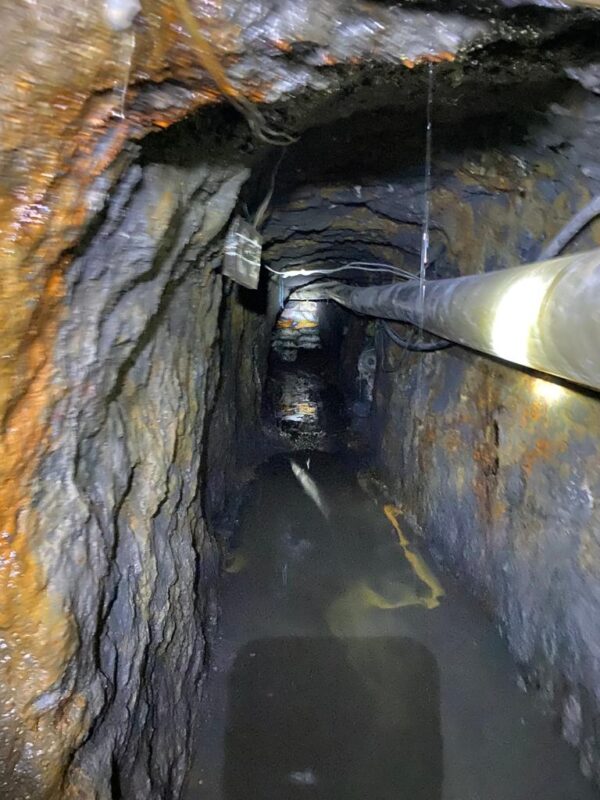
In the evening, we wound down together after the day’s experiences. We played billiards, enjoyed a hearty dinner, and had a few cervezas. After the dusty, humid, and physically demanding hours underground, we appreciated the relaxed atmosphere all the more.
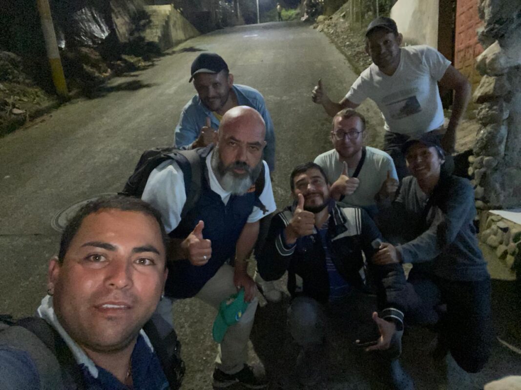
The following morning, our journey would continue via Chiquinquirá towards Muzo.
Gachalá and Chivor – Similarities and Differences
Within just a few days, I had become familiar with both the Gachalá and Chivor districts of the eastern emerald belt. But what do these two regions actually have in common geologically, and how do they differ?
First of all, both districts are located along the eastern margin of the Eastern Cordillera and are associated with Lower Cretaceous sedimentary sequences. In both areas, dark, organic-rich claystones and black shales, as well as carbonate and evaporite-influenced horizons, play an important role. The emeralds formed through the circulation of highly saline hydrothermal fluids within these sedimentary rocks; there is no direct connection to magmatic intrusions [11][12]. Emerald mineralization in the eastern belt is generally dated to around the Cretaceous–Paleogene boundary, approximately 65 million years ago [12].
The mineral assemblages also show clear similarities. Characteristic associated minerals include albite, calcite, dolomite, and pyrite [9][11]. Another important similarity lies in the tectonic control of mineralization. Detachment horizons, listric normal faults, extensional fractures, and related breccia structures have been documented in the eastern emerald belt. These structures allowed hydrothermal fluids to circulate and created open spaces in which mineralized veins and breccias could form [11][12].
The present-day Eastern Cordillera, by contrast, is strongly shaped by folding and thrust faulting. This younger compressional overprint should not be confused with the structures that were active at the time of emerald formation. The structures that were critical to mineralization in the eastern belt are generally attributed to a local extensional tectonic regime [1][12].
An important distinction between the two districts lies in their stratigraphic host formations. In Gachalá, mineralization is particularly associated with the Santa Rosa Formation, whereas in the Chivor district the Chivor Formation represents a major host unit. Both formations date to the Berriasian, the earliest stage of the Lower Cretaceous, but represent different local facies developments [11].
A particularly distinctive feature of the Chivor district is a bedding-parallel evaporite and breccia horizon. This mineralized horizon can be traced for more than ten kilometres and locally reaches a thickness of up to about ten metres. It formed in connection with the dissolution of evaporitic layers and today consists partly of hydrothermal breccias and strongly albitized rocks. Numerous mineralized faults, extensional fractures, and veins branch off from this level [12].
Breccias, hydrothermal veins, and structurally controlled mineralization zones are also of central importance in Gachalá. There, the Santa Rosa Formation consists, among other lithologies, of organic-rich claystones containing intercalated, hydrothermally altered evaporitic horizons. Emerald-bearing veins and breccias likewise occur in association with intense albitization [9][11]. However, the particularly prominent breccia horizon that can be traced regionally over many kilometres has been described primarily from Chivor [12].
The evaporitic influence and albitization are therefore particularly well documented in the Chivor district. The dissolution of original evaporites created breccias and cavities, while at the same time the surrounding rock underwent intense hydrothermal alteration. In some places, the original evaporitic layers were almost completely replaced by albite and transformed into so-called albitites [11]. On many hand specimens, however, this albite is macroscopically far less conspicuous than the often clearly visible carbonates and pyrite.
During my visit, I gained the impression that mining in Chivor was more strongly concentrated within a continuous mining and structural zone. This impression was reinforced by the terraced historic workings, the numerous closely spaced mine entrances, and the succession of working levels. In Gachalá, by contrast, the individual mining areas appeared to me to be more widely dispersed and more often divided into smaller mine complexes. This is, however, primarily my personal impression of the areas I visited and should not be understood as a generally applicable geological distinction between the two districts. This is, however, primarily my personal impression of the areas I visited and should not be understood as a generally applicable geological distinction between the two districts.
In any case, the differences should not be interpreted too schematically. In both districts, I encountered predominantly dark to black host rock underground. The light-coloured matrix of many emerald specimens offered for sale, by contrast, often consisted of hydrothermal vein mineralization containing carbonates and, in some cases, albite. For this reason, it is by no means always possible to determine from a single hand specimen whether it comes from Gachalá, Chivor, or even from a district in the western emerald belt.
Via Chiquinquirá to Muzo and the Western Emerald Belt
The following day, we continued our journey to Chiquinquirá.
The city formed a striking contrast to the warm, humid mountain valleys of Chivor. Chiquinquirá lies in the highlands of Boyacá and is best known as an important pilgrimage centre. The Basílica de Nuestra Señora del Rosario de Chiquinquirá houses the famous image of the Virgen de Chiquinquirá, who was crowned Queen and Patroness of Colombia in 1919 [19].
For us, however, the city was primarily a stop along the way. Beyond Chiquinquirá, the long descent into the densely forested mountains began once again—this time towards the western emerald belt and Muzo.
In Chiquinquirá, Alejandro introduced me to Patricia. She also worked in the tourism sector and had numerous contacts throughout the western emerald belt region.
We first got to know each other over a relaxed lunch. At a restaurant not far from the plaza, we ordered “El Plato del Campesino.” What arrived was an enormous platter with potatoes, rice, and chicken. The portion was so generous that even after the meal there was still enough left to pack up and take with us.
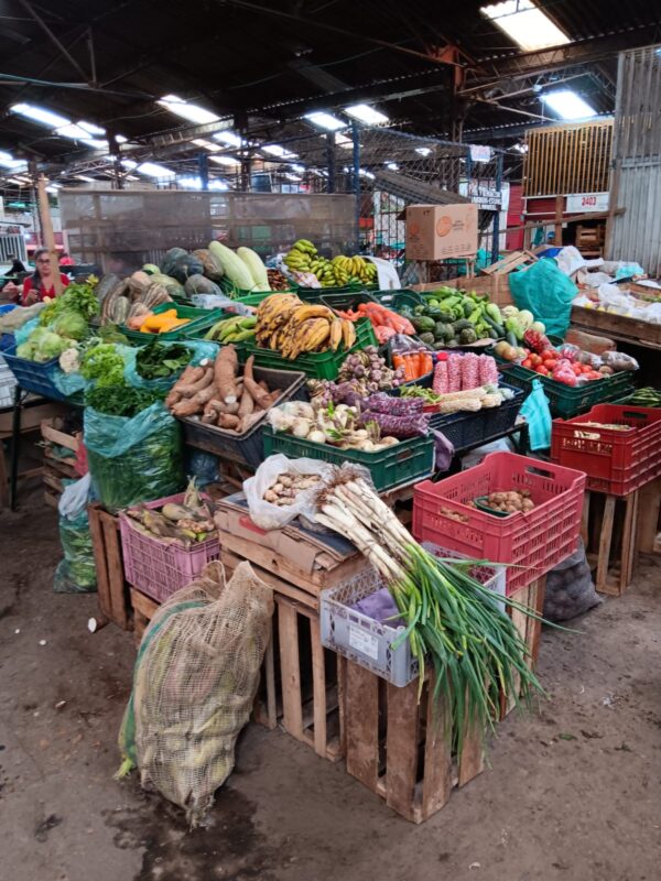
Afterwards, we visited the municipal market of Chiquinquirá to stock up on plenty of fruit, vegetables, and other provisions for the onward journey. The market stalls were piled high with bananas, yuca, potatoes, onions, tomatoes, and numerous other regional products.
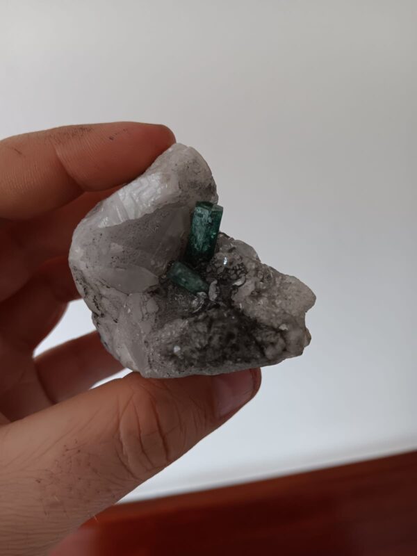
Not far from the plaza, I then made an unexpected purchase: a miner offered me an attractive emerald specimen from the Coscuez Mine in the western emerald belt. Two green crystals sat on a light-coloured calcite matrix. Since Coscuez was to be one of the next stops on our journey anyway, the specimen fitted perfectly with the stage ahead.
On the Way to the Western Emerald Belt – The Districts of Maripí, Coscuez, and Muzo
The following day, we continued our journey, and I was extremely excited. I could hardly wait to explore some of the mines of the western emerald belt.
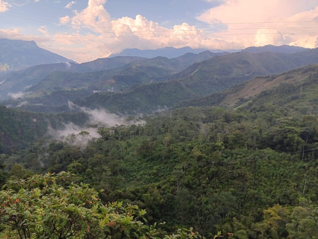
Beyond Chiquinquirá, the landscape changed noticeably once again. At the same time, temperatures began to rise significantly. The open, cooler highlands gradually gave way to a deeply dissected and more densely forested mountain landscape. The road wound through countless bends deeper into the western flank of the Eastern Cordillera.
Patches of mist lay between the green mountain slopes, while successive mountain ranges were already visible on the horizon. For me, this section of the journey was particularly impressive, as we were now approaching the western emerald belt—and with it some of Colombia’s most famous emerald-producing regions [1].
La Pita Mine in the Maripí District
Beyond Chiquinquirá, the road took us deeper and deeper into the densely forested mountain landscape of the western emerald belt. Our first destination, however, was not yet Muzo. We first made a detour to the La Pita Mine near Maripí, one of the region’s major emerald mines. Only afterwards did we plan to continue on to Muzo.
Patricia had already told me the previous evening that she had contacts at the La Pita Mine. I immediately knew that I wanted to take advantage of this opportunity. La Pita is located in the municipality of Maripí and forms part of Colombia’s western emerald belt [1].
The mine opened in 1995. Its first significant emerald production came in 1999, after miners encountered an emerald-bearing zone [1]. Since then, La Pita has developed into one of the important producing mines of the Maripí area.
What is particularly remarkable is the scale of production there, especially compared with some of the smaller mines I had previously visited in the eastern emerald belt. In 2015, the mine manager at the time, Javier Puerto, told a GIA team that the estimated value of rough emeralds produced at La Pita since 1999 exceeded one billion US dollars [1].
It quickly became clear, however, that the La Pita Mine was anything but easy to reach. The steep, unpaved ascent was simply too demanding for Jaiver’s car without four-wheel drive. After several attempts, we therefore decided not to force the drive any further.
Instead, we caught a ride to the mine in another four-wheel-drive vehicle, while Jaiver stayed behind in the village with his car. That was clearly the better option than risking a ruined clutch halfway up the mountain.
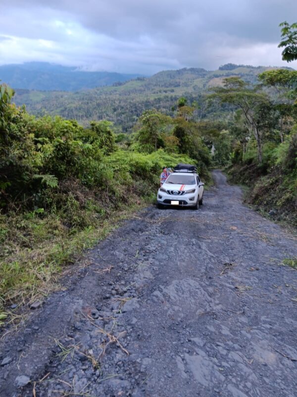
After an estimated 20-minute drive, we reached the mining area. At first, we waited near a simple complex of barracks before we were allowed to enter the mine. Unfortunately, we had left the insect repellent in the car, and within a short time we were covered in bites from countless tiny, barely visible insects. Surprisingly, the marks had almost completely disappeared again just a few hours later.
After around 45 minutes of waiting, the time had finally come. We took a group photo in front of the mine entrance before eventually being allowed to enter.
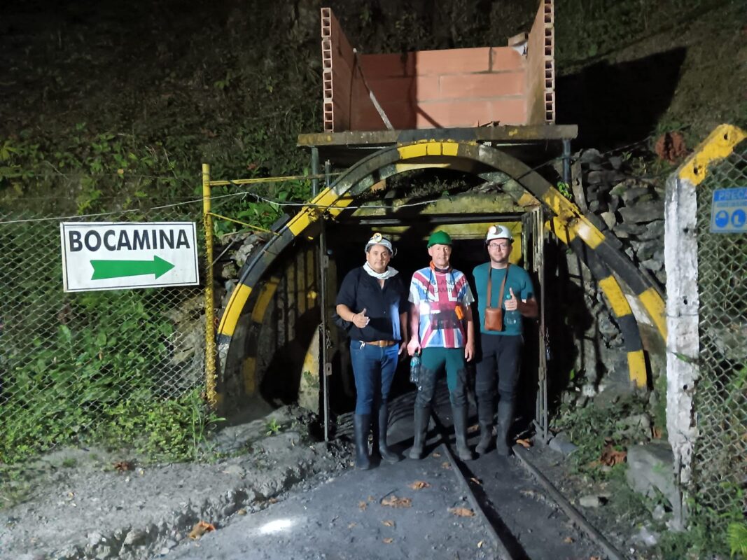
Even at the entrance, it was clear that La Pita operated on a different scale. The site was secured, the mine entrance reinforced and clearly signposted. Overall, the infrastructure appeared considerably more professional and modern than at many of the smaller mines I had visited previously.
The main adit extended far into the mountain and provided access to several deeper working levels. During our visit, we used a rail-mounted, cable-hauled transport system to descend to one of these levels. The dimensions of the underground workings made it clear just how technically organised and extensive La Pita was compared with the small-scale mines we had visited earlier.

During a GIA visit in 2015, five working levels were described; the fifth was located around 110 metres below the main adit. At that time, the underground workings extended from approximately 120 metres below to around 30 metres above the level of the main adit [1].
Mine ventilation also differed markedly from that of many smaller operations. Fresh air was mechanically supplied to the underground workings, and the mine also had several emergency exits and ventilation shafts. According to the management at the time, around 120 people worked per shift, with two shifts operating each day. At the same time, only about 8 to 10 percent of the deposit had been mined by 2015 [1].
The Journey to Muzo
In the evening, we finally continued on to Muzo. For the next few days, the town would serve as our base in the western emerald belt. We had chosen the Hotel Muzo as our accommodation.
Few places in Colombia are as closely associated with emeralds as Muzo. The town is still regarded as the “World Capital of Emeralds”, and the mining of green beryl has shaped the region for centuries [20]. The Indigenous Muzo people were already familiar with and traded emeralds long before the Spanish conquest. After prolonged resistance by the Muzo, the Spanish founded the Villa de la Santísima Trinidad de los Muzos in 1559 [20].
Although Chivor was initially exploited by the Spanish earlier, Muzo quickly gained importance during the colonial period. When Chivor was abandoned in the 17th century and remained largely forgotten for around two centuries, the focus of Colombian emerald mining shifted decisively to the Western Emerald Belt [17]. The quality of the often deep-green emeralds from Muzo eventually made the name Muzo famous worldwide.
Muzo is far more than just a single mine. The town forms the centre of an entire emerald-producing region in western Boyacá. The neighbouring districts of Quípama, Maripí, and Coscuez are also closely connected to it both economically and historically [1][20]. To this day, emerald mining and trade remain the municipality’s most important economic activities; yuca, cacao, coffee, and sugar cane also play a significant role [20].
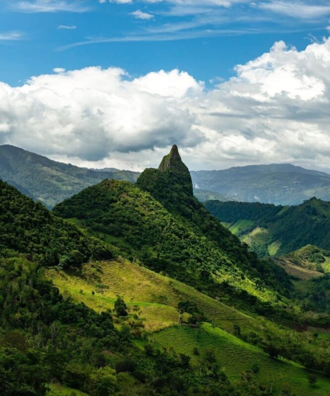
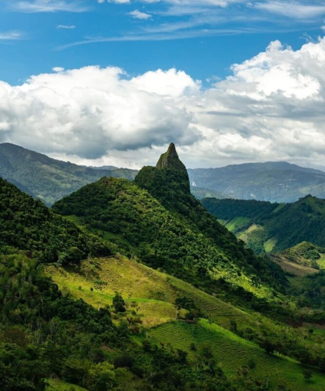
Also inseparably linked with the landscape of the western emerald belt are the Cerros Fura y Tena. These two striking rock peaks are among the best-known landmarks of the region. According to local tradition, they are connected with the origin of the emeralds; at the same time, the Río Minero separates the two mountains [20].
We had now reached a region whose name has been used almost synonymously with Colombian emeralds for centuries.
Visiting Two Small Mines in the Muzo District
The following day, we visited two smaller mines within the Muzo district. As in Chivor, I found it difficult to keep track of the individual workings within the Muzo mining area. The name Muzo by no means refers to a single mine entrance, but rather to a historically developed mining complex with numerous shafts, galleries, and extraction areas. The classic mines include Puerto Arturo, Tequendama, and Catedral; today, Volveré and the modern La Rampa are also among the most important parts of the district [1].
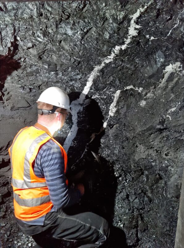
In the Muzo district, emerald mineralization occurs predominantly in Lower Cretaceous black, carbon-rich, and partly calcareous shales associated with carbonate rocks. These host rocks are mainly assigned to the Rosablanca Formation and the Paja Formation [1].
Not all black shales are equally favourable for mineralization. Calcareous and carbon-rich sections are particularly prospective for emeralds, whereas more siliceous intervals may be largely barren. Traditionally, miners also distinguish between such rock types using their own local terms.
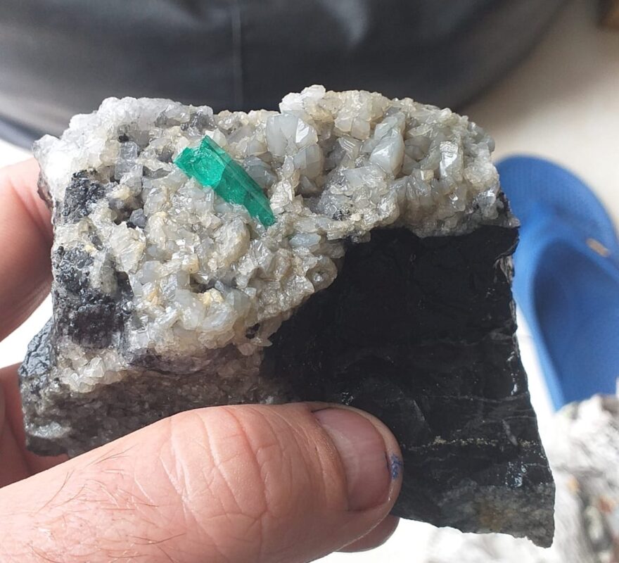
The emeralds frequently occur in light-coloured hydrothermal carbonate veins and breccias within the dark host rock. Calcite and dolomite are dominant, while associated minerals may include albite, quartz, fluorite, barite, pyrite, bitumen, and parisite-(Ce) [1].
Most mines in the district are comparatively small. Ventilation conditions also vary considerably from one operator to another. While some adits are more technically developed, others appear much simpler and more improvised.
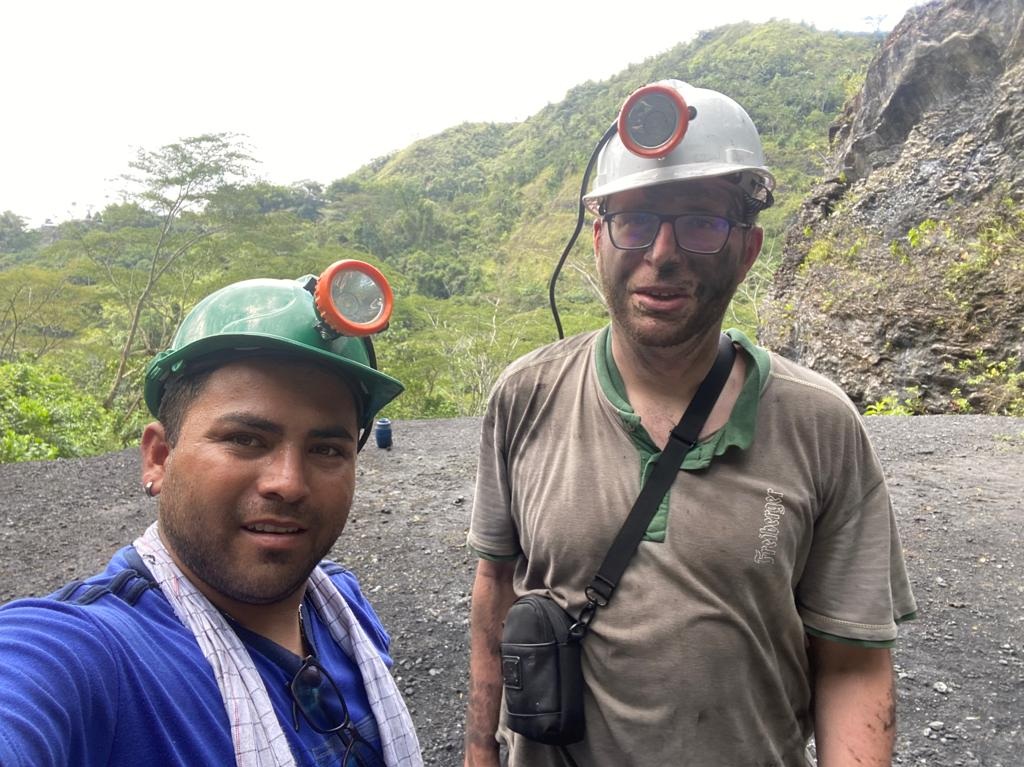
As in the Chivor district, tunnel advance is carried out mainly using pneumatic rock drills followed by blasting [1]. What struck me in particular were the underground climatic conditions: in several adits, temperatures exceeded 30°C, while humidity was extremely high at the same time. As a result, the air sometimes felt heavy and oppressive, even during relatively short visits.
We visited only two mines here and stayed underground for a limited time, yet in both of them my glasses had completely fogged up after about a minute. I found it difficult to imagine working under such conditions for eight hours or more.


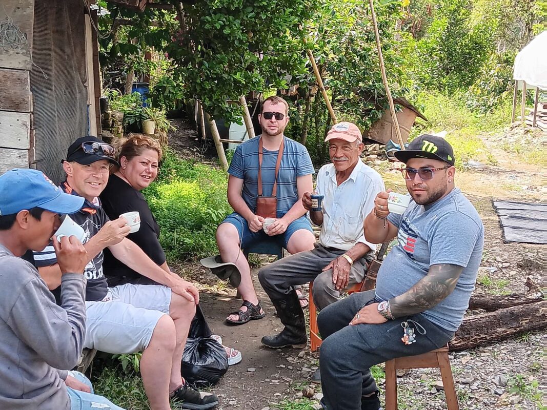
After visiting the mines, I was glad that a visit to a coffee plantation was planned for the afternoon. After the previous days underground and the sometimes very strenuous hot and humid conditions, this promised to be a welcome change.
Coffee is now grown in 23 departments and in more than 600 municipalities across Colombia. More than 540,000 families depend directly or indirectly on coffee cultivation, which has long since expanded beyond the well-known Coffee Triangle [22].
Coffee also remains one of the country’s most important export products. According to the Federación Nacional de Cafeteros, Colombian coffee production reached around 13.7 million 60 kg bags in 2025, while exports amounted to approximately 13.14 million bags [21]. Colombian coffee continues to enjoy an excellent reputation, particularly on the international market for high-quality Arabica.
After visiting a coffee plantation near Muzo. A cup of freshly prepared Colombian coffee offered a welcome change after the demanding mine visits of the previous days.
A Visit to the Coscuez District
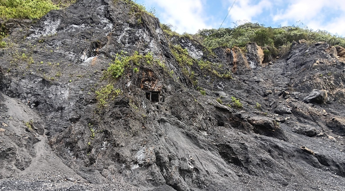
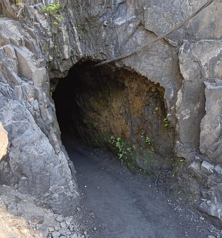
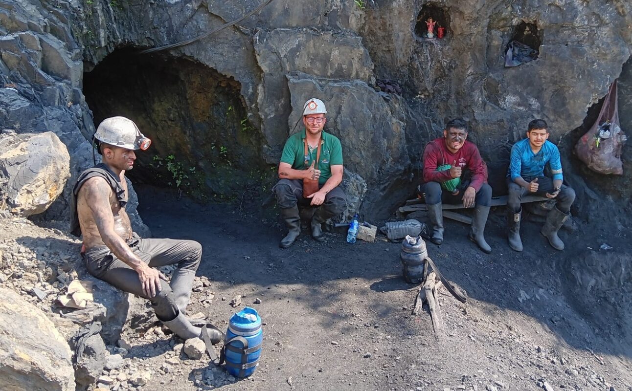
Coscuez was to be the final stop before our return to Bogotá. The Coscuez district lies only around ten kilometres from Muzo and, like Muzo, forms part of Colombia’s western emerald belt [23].
Geologically, Coscuez and Muzo share many similarities. In both districts, emerald mineralization is associated with Lower Cretaceous carbon-rich and calcareous black shales, as well as hydrothermal carbonate veins and breccias [1][23]. Their associated minerals are also very similar. Typical minerals include calcite, dolomite, pyrite, quartz, parisite, fluorite, apatite, albite, and barite [23].
As elsewhere in the western belt, tectonic deformation also played a crucial role at Coscuez. The mineralization is hosted by a strongly folded and faulted structural system, with the mineralizing fluids preferentially circulating along fractures, shear zones, thrust structures, and brecciated zones [1][23]. The breccias and carbonate veins described there closely resemble those found at Muzo.
Historically, Coscuez is closely linked to Muzo and has been known for centuries as an important emerald-mining district. Despite their geographic proximity, however, Coscuez is a distinct deposit with its own mining history [23]. Emeralds from Coscuez can closely resemble those from Muzo. Gemmologically, however, Coscuez is often described as showing a somewhat broader range of hues and colour saturations [23]. For this reason in particular, reliably assigning individual crystals to one locality based solely on their outward appearance is often extremely difficult.
Before we reached the actual mines, we passed through a small trading area in the immediate vicinity of Coscuez. Emeralds appeared to be traded there far more informally than in the larger towns. Numerous miners, guaqueros, dealers, and other visitors moved between simple stalls and buildings. To me, the atmosphere felt distinctly rough and confusing—almost like a scene from a Western. Although I took many photographs during the journey, I deliberately refrained from openly taking out my camera or phone here.
Directly below the mines, there was also a densely built-up settlement that appeared very simple. Many people in this area depend directly or indirectly on emerald mining—as miners, guaqueros, dealers, or through services provided to the mining community. Here in particular, it became clear just how closely mining, trade, and everyday life are intertwined in Coscuez.
We had been outside the car for barely two minutes. During that brief time, Jaiver had forgotten to lock the vehicle. When we returned, a woman was suddenly sitting inside and apparently searching through our belongings. She immediately left the car as we approached. This brief incident reinforced my impression that it was better to remain alert in this area. In retrospect, I was glad that I had not openly displayed a camera or other valuables there. As far as we could tell, however, nothing had been stolen.
Eastern and Western Emerald Belts – Similarities and Differences
Colombia’s emerald deposits are concentrated in two roughly parallel belts along the flanks of the Eastern Cordillera. The eastern emerald belt includes primarily Chivor, Gachalá, and Macanal, while the western belt includes Muzo, Coscuez, La Pita, Peñas Blancas, and Yacopí, among others [1][12].
Despite their geographic separation, both belts are based on a broadly similar geochemical system. The emeralds formed through the circulation of hot, highly saline hydrothermal fluids within Lower Cretaceous sedimentary rocks. Unlike many other emerald deposits around the world, those in Colombia show no direct association with magmatic intrusions [1][12].
The saline fluids reacted with the sedimentary host rocks and mobilized the elements required for emerald formation, including beryllium, chromium, and vanadium. Under suitable physicochemical conditions, emerald could then crystallize [12]. The exceptionally high salinity of these fluids can still be demonstrated today by multiphase fluid inclusions in Colombian emeralds. In addition to liquid and a gas bubble, these inclusions often contain cubic halite crystals that crystallized as daughter minerals as the trapped brine cooled [12].
Clear differences, however, exist in the age and tectonic setting of the mineralization. The emeralds of the eastern belt formed approximately around the Cretaceous–Paleogene boundary, about 65 million years ago. Their formation is associated with a local extensional tectonic regime. Characteristic structures include normal faults, extensional fractures, and listric structures branching from a bedding-parallel, hydrothermally brecciated horizon that was originally rich in evaporites. This system is particularly well documented in the Chivor district [1][12].
The mineralization of the western belt, by contrast, is significantly younger. It formed around the Eocene–Oligocene boundary, approximately 32 to 38 million years ago, and is associated with a compressional tectonic regime. In Muzo and Coscuez, thrust faults, folds, and strike-slip faults or tear faults in particular controlled the circulation of hydrothermal fluids. Mineralized veins and hydraulic breccias preferentially developed along these structures [1][12].
The host rocks also differ. In the western belt, the emeralds occur mainly in carbon-rich calcareous black shales and interbedded dolomitic limestones of Lower Cretaceous age. In the classic literature, these sequences are assigned particularly to the Rosablanca and Paja formations [12]. The light-coloured calcite and dolomite veins often stand out clearly against the almost black host rock—an appearance I repeatedly encountered in Muzo and Coscuez.
In the eastern belt, by contrast, the deposits are hosted by older, predominantly Berriasian sedimentary sequences. In Gachalá, the Santa Rosa Formation plays a particularly important role, while in Chivor the Chivor Formation is a major host unit. Dark, organic-rich shales also occur here, alongside carbonate and evaporite-influenced sediments as well as pronounced albitization [11].
During my journey, however, it became clear to me that these geological differences cannot always be identified unambiguously from an individual hand specimen. Dark host rocks and light-coloured carbonate veins also occur in Chivor and Gachalá. At the same time, emerald specimens from different districts can look surprisingly similar when they occur on light-coloured vein matrix. Reliable provenance determination based solely on colour or matrix is therefore often not possible.
The associated mineral assemblages also overlap considerably. In both belts, calcite, dolomite, pyrite, and albite are among the typical associated minerals, while additional species occur depending on the individual deposit [1][12]. A characteristic feature of the western belt, however, is the occurrence of the famous trapiche emeralds. They are particularly well known from Muzo, Coscuez, and Peñas Blancas and are genetically associated with the compressional structures and hydraulic brecciation of this belt [12].
Despite these geological differences, my impressions underground were often surprisingly similar. In both the eastern and western belts, mining ranged from small, simply developed adits to much more technically sophisticated operations. Pneumatic rock drills, blasting, high humidity, dark sedimentary rocks, and light-coloured mineralized veins accompanied me in both regions.
Only a closer look at the stratigraphy, structural geology, and age of mineralization reveals that these initially similar impressions actually reflect two different phases in the geological evolution of the Eastern Cordillera: an older, predominantly extensional phase of emerald mineralization in the east and a significantly younger, compressionally controlled phase in the west [1][12].
Comparison of the Two Emerald Belts
| Feature | Eastern Emerald Belt | Western Emerald Belt |
| Major Districts | Chivor, Gachalá, Macanal | Muzo, Coscuez, La Pita, Peñas Blancas, Yacopí |
| Age of Mineralization | approx. 65 million years | approx. 32–38 million years |
| Tectonic setting | predominantly locally extensional | compressive |
| Typical structures | normal faults, listric faults, extensional fractures, breccias | thrust faults, folds, tear faults, hydraulic breccias |
| Host rocks | Lower Cretaceous shales, carbonates, and evaporite-influenced sediments | calcareous, carbon-rich black shales and dolomitic limestones |
| Typical vein minerals | calcite, dolomite, pyrite, albite | calcite, dolomite, pyrite, albite |
| Characteristic Feature | regional evaporite-influenced breccia horizon, particularly well developed in Chivor | trapiche emeralds; mineralization along compressional structures |
Conclusion of My Journey Through Colombia’s Emerald Regions
When I planned my journey through Colombia’s emerald regions, I already knew quite a bit from the literature about Muzo, Chivor, and the extraordinary formation of these deposits. Only once I was there, however, did I realize just how much more complex the reality behind the famous green crystals actually is.
I encountered small, family-run adits as well as mines developed with far more sophisticated technical infrastructure. I saw emeralds directly in the exposed rock, followed calcite veins through dark black shales, and experienced firsthand the sometimes extreme conditions under which the miners work. Heat, high humidity, dust, water in the adits, and the use of rock drills and explosives repeatedly made me aware of just how much effort can lie behind a single undamaged emerald crystal.
From a geological perspective, I found it particularly fascinating to be able to compare the eastern and western emerald belts directly. At first glance, many of the underground workings and even some hand specimens looked surprisingly similar. Only a closer examination of the stratigraphy, tectonics, and age of mineralization revealed the fundamental differences between the two belts. For me, this connection between what I had learned from economic geology and what I was ultimately able to observe in the field was one of the most valuable experiences of the journey.
Just as formative, however, were the encounters with the people. Miners took the time to explain their work, show me their finds, and invite us to share a tinto or a beer. At the same time, I encountered a region where emeralds are far more than just valuable minerals. In places such as Chivor, Muzo, and Coscuez, they shape the economy, history, everyday life, and often the hopes of the people.
After these journeys, I see Colombian emeralds differently. To me, a beautiful specimen is no longer simply a green beryl on matrix. I now associate it with the dark rock underground, the sound of the rock drills, the humid air in the adits, the steep trochas through the Eastern Cordillera, and above all the people who extract these minerals from the mountains.
My journey raised more questions than it answered. Yet for me, that is a large part of its fascination. Colombia’s emerald regions still offer countless geological and mineralogical topics that deserve closer attention. Some of them—such as parisite-(Ce), euclase, the different emerald deposits, or a comparison of Colombian emeralds with deposits in other countries—I would therefore like to explore in greater detail in future articles.
And this was probably not my last journey to Colombia’s emerald belts.
References
[1] Fortaleché, D.; Lucas, A.; Muyal, J.; Hsu, T.; Padua, P. (2017): Colombian Emerald Industry: Winds of Change. Gems & Gemology, Vol. 53, No. 3, GIA.
[2] Ringsrud, R. (1983): The Oil Treatment of Emeralds in Bogotá, Colombia. Gems & Gemology, Vol. 19, No. 3, GIA.
[3] Agencia Nacional de Minería (ANM): Decálogo de Ventilación de Labores Subterráneas en Colombia.
[4] Beus, A. A. (1979): Sodium – a geochemical indicator of emerald mineralization in the Cordillera Oriental, Colombia. Journal of Geochemical Exploration, Vol. 11.
[5] Piraquive, A. et al. (2026): Panoramic Transect of the Western Flank of Eastern Cordillera Fold and Thrust Belt, Northern Andes, Colombia. Journal of South American Earth Sciences.
[6] Smithsonian National Museum of Natural History: Gachala Emerald.
[7] Parques Nacionales Naturales de Colombia (2022): Los páramos de Colombia tienen más de 31.000 nuevos frailejones.
[8] Weldon, R.; Ortiz, J. G.; Ottaway, T. (2016): In Rainier’s Footsteps: Journey to the Chivor Emerald Mine. Gems & Gemology, Vol. 52, No. 2, GIA.
[9] Hernández Rangel, A. D.; Romero Ordóñez, F. H.; Molano Mendoza, J. C. (2026): Mineralogical and Petrographic Characterization of the Emerald Mineralizations in the Vereda El Diamante, Gachalá, Cundinamarca (Colombia).
[10] Moreno, G.; Terraza, R.; Montoya, D. (2009): Geología del Cinturón Esmeraldífero Oriental (CEOR).
[11] Petrochronology of monazite and xenotime from emerald deposits in the Eastern Cordillera of Colombia: constraints on the hydrothermal evolution of the Cretaceous basin. Mineralium Deposita, 2026.
[12] Giuliani, G. et al. (2015): Colombian Trapiche Emeralds: Recent Advances in Understanding Their Formation. Gems & Gemology, Vol. 51, No. 3, GIA.
[13] CORPOGUAVIO (2024): Boletín 74/2024 – Capacitación Gremio Minero Municipio de Gachalá.
[14] Agencia Nacional de Minería: Bergbautitel HK9-08091.
[15] Observatorio de Cultura y Patrimonio de Boyacá: Chivor.
[16] Schmetzer, K.; Martayan, G.; Blake, A. R. (2020): History of the Chivor Emerald Mine, Part II (1924–1970): Between Insolvency and Viability. Gems & Gemology, Vol. 56, No. 2, GIA.
[17] Schmetzer, K.; Martayan, G.; Ortiz, J. G. (2020): History of the Chivor Emerald Mine, Part I (1880–1925): From Rediscovery to Early Production. Gems & Gemology, Vol. 56, No. 1, GIA.
[18] Agencia Nacional de Minería (ANM): Proyectos mineros – esmeraldas.
https://www.anm.gov.co/proyectos-mineros-esmeraldas
[19] Diócesis de Chiquinquirá: Basílica Nuestra Señora del Rosario – Chiquinquirá, Boyacá.
https://diocesisdechiquinquira.org/bas%C3%ADlica-nuestra-se%C3%B1ora-del-rosario-chiquinquir%C3%A1-boyac%C3%A1
[20] Sistema de Información Turística Regional – SITUR Boyacá / Gobernación de Boyacá: Municipio de Muzo sowie Fura y Tena.
https://situr.boyaca.gov.co/occidente/municipio-de-muzo/
https://situr.boyaca.gov.co/atractivo-turistico/fura-y-tena/
[21] Federación Nacional de Cafeteros de Colombia: Eje económico.
https://federaciondecafeteros.org/eje-economico/
[22] AgroNet – Observatorio de Información Rural y Agropecuaria: Día Internacional del Café.
https://agronet.gov.co/noticias/dia-internacional-del-cafe
[23] Ringsrud, R. (1986): The Coscuez Mine: A Major Source of Colombian Emeralds. Gems & Gemology, Vol. 22, No. 2, Gemological Institute of America.
https://www.gia.edu/gems-gemology/summer-1986-colombia-emeralds-ringsrud
